 |
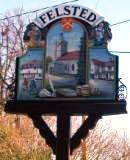
Felsted |
| Home | Felsted in Autumn | Roll of Honour Project | Links |
Welcome to FelstedFELSTED the ancient idyllic village recorded in the Domesday Book of 1086, has many listed houses, barns and water pumps and beautiful old houses many of which are of timber construction most with tiled roof and a few thatched. FELSTED’s name is formed from the two words Fell, a hill, and Stede, a place; a hilly-place. It has been written in records –Felstede (Ulsi’ under Earl Elfgar), Feldelsted, Felstead, Felestelda, Phensted and Phensteda (King Edward time). FELSTED lies on the byroad, B1417, and situated 5 miles from Great Dunmow and 6 miles from Braintree. The ancient Roman road from Braughing on Ermine Street in Herfordshire runs almost in the direct line through Bishop’s Stortford to Colchester, now the A120. For a distance of two miles, this ancient highway forms the northern boundary of FELSTED parish. The middle section of this highway is called ‘Stane Street’ and is part of the boundary of FELSTED parish. To the west and south of the village the River Chelmer and its tributary, the Stebbing Brook marks the parish boundary. The eastern boundary is very irregular extending nearly as far as another Roman road running south from Braintree to Little Waltham. FELSTED is a large parish which encompasses many small hamlets most of which have the word ‘Green’: Bannister Green, Cobblers Green, Cock Green, Frenches Green, Gransmore Green, Mole Hill Green, Pyes Green, Thistley Green, Willow Green. FELSTED offers over 40 miles of Public Right of Way including, Bridle Paths (walkers, cyclists and horse riders), Foot Paths (walkers only) and Byways (walkers, cyclists, horse riders and vehicles) and Quiet Lanes (walkers, cyclists, horse riders and vehicles) and lots more such as pubs, shops, schools, surgery, parks, clubs etc. |
|||||||||||||||||||||||||||||||||||||
|